
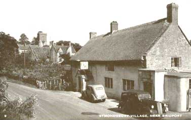
Symondsbury
including Broadoak, Eype and West Bay
|
Symondsburyincluding Broadoak, Eype and West Bay |
|
| Symondsbury is a parish and
village situated to the east of Bridport. In the north it is adjacent to
Netherbury and then runs to the coast between Chideock on the west and Allington, Bridport and
Bothenhampton on the east.
The River Simene meanders through Symondsbury from its source just north of the parish and meets with the River Brit before it flows to the sea at West Bay The church of St John the Baptist is in Early English style and cruciform shape, it has a nave, trancepts, south porch and square tower with 5 bells and a clock. The registers date from 1558. |
 |
 |
There is also a chapel of ease of St Peter built at
Eype, a small village closer to the coast, Higher Eype being 1 mile from
Symondsbury and Lower Eype 1½ miles. Other hamlets are Miles Cross, half
a mile south and Broadoak 2 miles north. There is also a chapel of ease
(St Paul)
at Broadoak erected in 1865. The land is rolling hills with cliffs to
the sea edge. The soil is clay and sand and the chief crops are grass,
wheat, barley and oats. There is an endowed school with a large
schoolhouse erected in 1865. The population in 1891 was 1186 of which
186 were included in the municipal borough of Bridport. Information from Kelly's Directory 1895. Symondsbury Parish Council has an excellent web site including contemporary photographs |
The Online Parish Clerks for Symondsbury are Les & Lesley Keatley You can contact Les & Lesley by clicking on the link above which should generate a correctly addressed email. Please note new email address (April 2023). |
|
| Census |
1841 Census transcribed by Jacqui Bowen in 3 districts 1851 Census 1861 Census transcribed by Peter Collins 1871 Census transcribed by Jacqui Bowen in 2 districts 1881 Census 1891 Census 1901 Census |
| Parish Registers |
Baptisms 1813-1820 [Liz Draper] Marriages 1558-1812 [Peter Collins] |
| Monumental Inscriptions | Broadoak St Paul MIs |
| Postal Directories | |
| Photographs | Donations welcomed |
| Maps | |
|
View Larger Map |
|
| Records held at the Dorset History Centre [PE/SYM] |
Registers Christenings 1558/9-1954. Marriages 1558-1646, 1653-1676, 1684-2012. Burials 1558/9-1646, 1653-1676, 1684-2010. Banns 1754-1968. Transcripts Christenings 1558/9-1812, 1953-1999. Marriages 1558-1756. Burials 1558/9-1626, 1903-2000. Indexes Christenings, marriages and burials 1813-1837. |
| Registration District
(for the purpose of civil registration births, marriages & deaths) |
1 Jul 1837-31 Mar 1997: Bridport 1 Apr 1997-30 Sep 2001: West Dorset 1 Oct 2001-17 Oct 2005: South & West Dorset |
Visitors to Dorset OPC
Copyright (c) 2025 Dorset OPC Project